Showing posts with label Tennessee. Show all posts

January 26, 2015

Virgin Falls


One of my 2014 goals was to hike to Virgin Falls near Sparta, Tennessee. In case you missed this blog post from January 2014, here it is again.

While I didn't accomplish this goal in 2014, I did make it in January 2015 and share below a few glimpses of Virgin Falls as well as other beautiful sites along the trail.  


Virgin Falls is formed by an underground stream that emerges from a cave and then drops over a 110-foot high cliff. 

Here is more information on the Virgin Falls State Natural Area along with directions to the trailhead.  This area is part of Tennessee's Cumberland Plateau. 


The area is noted for its unique geological features and several other waterfalls. 

Big Branch Falls

The hike into Virgin Falls totals around 9 miles (in and out) and is considered a strenuous hike.  The trail descends around 900 feet in elevation and has many rocky areas with uneven footing. 

There is a cable to provide assistance at the only difficult stream crossing. 


Big Laurel Falls 

Top of Virgin Falls 

Side view of Virgin Falls. 

Winter or early Spring is the ideal time for a hike to Virgin Falls.  Be sure to allow plenty of time to see all of the fascinating geological formations along the way as well as explore the trail to the top of the Falls. 

Hope you enjoyed my hike to Virgin Falls and you have plans in 2015 to "Keep on Hiking."

January 17, 2014

Polar Vortex Creates Winter Wonderland


Why would anyone go hiking in the January 2014 polar vortex?  It seemed a once-in-a-lifetime chance since it hasn't been this cold in the southeastern United States for 20 years. It was also an opportunity to enjoy a beautiful winter wonderland in the Grundy Forest State Natural Area near Tracy City, Tennessee with elevations high enough to receive a beautiful dusting of snow.

It also helped there were 16 other hikers who were willing to brave the frigid cold temperatures, so misery enjoys company, right?  Actually it wasn't miserable at all if you're dressed for the temperature.  In case you're wondering what I wore, here we go from head to toe: Patagonia toboggan or beanie, ear muffs (LL Bean has some good ones), scarf to wrap around my neck and face (if necessary), UniQlo Heattech turtleneck (first layer), North Face crew neck base layer (second layer), Omni-Heat Reflective Columbia jacket, LL Bean Baxter State gloves, Cuddle Duds leggings, Champion sweat pants, two pairs of socks (SmartWool crew socks and SmartWool hiking socks), and Keen hiking boots.


The Grundy Forest State Natural Area is about an hour's drive (48 miles) north of Chattanooga. It is part of the South Cumberland Recreation area which is a group of ten separate park areas managed as a single park.  Totaling over 16,000 acres, the units are located throughout a 100-square-mile region within Grundy, Sequatchie, Franklin, and Marion counties.   Here is more information.


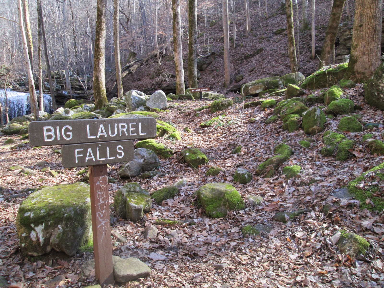
It was a slow paced, 3.6-mile hike which included the Grundy Forest Day Loop, Sycamore Falls, and the Dog Hole Trail. Here is a map and description of these trails.


Even in the snow, the first mile was very easy terrain since it traverses the flat plateau top.


At 1.3 miles, a bridge will take you across Little Fiery Gizzard Creek.


Crossing the bridge takes you to the the main Fiery Gizzard Trail, Sycamore Falls, and the Dog Hole Trail.


Little Fiery Gizzard Creek

The Little and Big Fiery Gizzard Creeks merge and cut a cascade which is known as the Black Canyon because of the organic stain on the rocks. 

More of the Black Canyon
Sycamore Falls 


(Photograph courtesy of John Rowland)
Because of the millions of rocks, the Fiery Gizzard Trail is one of the most rugged and difficult trails in Tennessee.


There are several legends surrounding the Fiery Gizzard name.  One legend includes Davy Crockett and a turkey gizzard.  I'll let you be the judge based on the various legends discussed here.


Blue Hole Falls 


After venturing off on the Fiery Gizzard Trail to Sycamore Falls and the Dog Hole Trail, it was back to the Grundy Forest Day Loop with the final stunning scenery of the day at Blue Hole Falls.  


Before the next winter wonderland hike, I plan to purchase Anti-Slip Ice Snow Crampon Cleats and Silicone Rubber Shoe Covers (pictured below) so I can "Keep On Hiking." 


December 4, 2013

50 Miles on the Cumberland Trail


She's a good old hiker and a good old pal, 50 miles on the ........... 


No, it's not the Erie Canal, but Tennessee's Cumberland Trail.  Having just completed more than 50 miles of section hiking on this trail, I hope today's post will enlighten you on the spectacular Cumberland Trail as well as inspire you to get out and enjoy this beautiful section of the southeastern United States.  

The Cumberland Trail is a remote footpath through east Tennessee and when completed, will pass from Kentucky to Georgia through 11 Tennessee counties on the eastern escarpment of the Cumberland Plateau.  The Cumberland Plateau is the most western portion of the Appalachian mountains and extends from West Virginia to northern AlabamaHere is more information on the Cumberland Plateau.  

Currently, the main trail has 126 open miles with 264 miles planned at completion. Of course, there are other trails which are connecting loops, spurs, and access trails that are considered part of the Cumberland Trail. Here is more information on the Cumberland Trail along with a detailed map, and information on the 14 segments currently open for hiking.

Enough details, let’s get to some photographs: 


My first hiking adventure on the Cumberland Trail was in October 2012.  I hiked with the Chattanooga Hiking Club on Signal Mountain to Mushroom Rock during Chattanooga's River Rocks Festival.  Here is more information on the Chattanooga Hiking Club.  (Photograph courtesy of Don Deakins.)

Included in the October 2012 hike was Edwards Point, a rocky ledge overlooking the beautiful Tennessee River.  Here is a map to the Tennessee River Gorge Segment which includes Mushroom Rock and Edwards Point.  

In December 2012, I hiked a portion of the Three Gorges Segment - Possum Creek Section near Soddy Daisy.  Pictured above is Little Possum Creek.  Here is a map to this section of the trail.  (Photograph courtesy of  Scott Piotrowski of Chattanooga Hiking Meetup.) 

Beautiful Imodium Falls was the destination of the December 2012 hike located on Little Possum Creek. It was an "in and out" hike starting at the Heiss Mountain Road trailhead and totaled 11.2 miles.  This is a lovely but strenuous hike.  (Photograph courtesy of Scott Piotrowski and Chattanooga Hiking Meetup.)


The Laurel-Snow Segment, near Dayton, includes both Laurel and Snow Falls. In January 2013, beautiful Laurel Falls was spilling over the gigantic boulders. Here is link to this segment of the trail. 

The trail to Laurel Falls follows beautiful Richland Creek for 1.5 miles and can be an "in and out" hike. 

The 10.-2 mile Mullens Cove Loop is part of the Tennessee River Gorge Segment which starts in the Prentice Cooper State Forest and Wildlife Management Area.   Pictured above is a view of the Tennessee River from Snooper's Rock in January 2013. 

A very scenic brook in beautiful Mullens Cove Gorge.  (Photograph courtesy of Chattanooga Hiking Meetup.) 

In February 2013, an exploration hike to the Three Gorges Segment - Possum Creek Section started at the Retro Hughes Road trailhead and ended at Heiss Mountain Road which is 9.5 miles.  It was a "shuttle" hike as transportation was needed at both trailheads.  If you're considering a shuttle hike of this segment, I suggest starting at Heiss Mountain and ending at Retro Hughes. 

Being a little more adventurous at the top of Imodium Falls on the exploration hike.

Imodium Falls is definitely the highlight of this segment of the Cumberland Trail.   According to the website, it was named by expert kayakers who wished they had taken some of this popular medicine upon approaching this c-shaped waterfall. (Photograph courtesy of Beth Hemann.) 

White Pine Cascades on the beautiful Piney River Segment near Spring City in February 2013.  Here is a link to the 8.46-mile section of the trail which is rated moderate for hiking.

Another beautiful cascade on Piney River. (Photograph courtesy of Chattanooga Hiking Meetup.) 

Three Gorges Segment - Rock Creek which is north of the Possum Creek Section.  Here is a link to this segment of the trail. 

This section was done as a "shuttle hike" starting from the Retro Hughes trailhead and ending at Upper Leggett Road.  Highlights of this section include Rock Creek, beautiful views of the gorge, and stunning rock formations.

Later, I hiked to Snow Falls on the Laurel-Snow Segment in May 2013.  It is a longer hike than Laurel Falls but well worth the additional mileage and stream crossing.  

The 150-foot bridge over Richland Creek on the way to Snow Falls

The third trip to Imodium Falls in October 2013 was a little disappointing.  Unfortunately, the abundant summer rain didn't last until Fall.  

On top of Brady Mountain on the Grassy Cove Segment in November 2013.  Here is a link to this segment of the trail. 

The Brady Mountain Arch. This section of the trail was done as a shuttle hike from Jewett Road trailhead to Highway 68. 

My fourth trek to the Three Gorges Segment - Possum Creek Section started at Heiss Mountain Road and ended at the Retro Hughes trailhead.  Just north of Imodium Falls on Little Possum Creek, these small cascades were a delightful discovery.  

I love sharing the outdoors with others and led my final trek to Imodium Falls for the Chattanooga Hiking Meetup on a beautiful day in late November.  Here is a link to Chattanooga Hiking Meetup.  

Special thanks to Cumberland Trail volunteer Don Deakins for trail maintenance, leading hikes, answering questions, and providing assistance for anything related to the Cumberland Trail. By the way, Don has a wonderful blog, Cumberland Trail Volunteers, and you can view it here.

In case you're wondering, the Cumberland Trail Conference has a 50-miler award which requires 10 hours of trail maintenance.  I hope to complete that 10 hours of trail maintenance soon so I can "Keep On Hiking."


August 18, 2013

Six Favorite Tennessee Waterfalls

Who doesn't love waterfalls?  While there are roads to the more notable ones, hiking is often required to view some of the lesser known, but equally stunning cascades.

For me, the anticipation of hiking to a waterfall has always paid off with spectacular results. The waterfalls listed here are in the Cumberland Plateau region of Tennessee.  Some are in state parks and are, therefore, a little easier to access; however, some require a hike!  Here are some of my favorite Tennessee waterfalls.

Cane Creek Cascades located in Fall Creek Falls State Park near Pikeville.
The park offers a variety of day-use trails that provide access to some of the park's loveliest areas including awesome gorges and waterfalls.  The Woodland Trail starts behind the Nature Center and crosses these cascades by way of a swinging bridge. 

Cane Creek Falls

All surface water in the park eventually pours into Cane Creek.  Its cascades (first photo)  have worn down the rocks of Cane Creek falls which is 85 feet high. The Gorge Overlook Trail offers overlooks of the falls. 


Fall Creek Falls

At 256 feet, Fall Creek Falls is the highest waterfall in the eastern United Sates.  Fall Creek Falls Sate Park is a paradise of more than 25,000 acres, sprawled across the western top of the rugged Cumberland Plateau.   There is a steep trail to the bottom of the falls. Here is more information on the park which is laced with cascades, gorges, waterfalls, and streams. 


Imodium Falls near Soddy Daisy 

Located in the Three Gorges Segment, Possum Creek Section, of the Cumberland Trail, it is a 9-mile difficult hike to the picturesque Imodium Falls.  Here is more information on this segment of the Cumberland Trail. 

Savage Falls located in the Savage Gulf Sate Natural Area near Monteagle

The Savage Gulf State Natural Area is one of Tennessee's most scenic state outdoor recreation areas.  The easy Savage Day Loop Trail gives the hiker a variety of features including overlooks of Savage Falls and access to several of the longer backcountry trails.  Here is more information on Savage Gulf. 

Burgess Falls near Sparta
The main 1.5-mile round trip river trail is moderately strenuous and takes you past four water falls on the Falling Water River.  Here is more information on Burgess Falls State Natural Area. 


As I explore more of the Volunteer State, this list of six waterfalls is sure to grow. Do you have a favorite you'd like to share.


Until next time, don't go chasing waterfalls, and Keep On Hiking!