May 9, 2014

Shirt Tales and Happy Trails


From hiking shirts to hiking boots, every hiker has their favorite gear. Columbia's Silver Ridge Short Sleeve shirt is my favorite hot weather hiking shirt. According to Columbia's website, the Silver Ridge is a "clean and classic go-anywhere short-sleeve shirt, loaded with ray-repelling features like UPF 40 sun protection, a flip-up collar and strategic venting to ensure that you stay cool and comfortable during everyday adventures or active outdoor excursions."  Here is more information from Columbia on the Silver Ridge.


The Columbia Silver Ridge is offered in solid colors and playful plaids.  Who wouldn't look smart and fit in this classic shirt?  


Here are a few of my happy trails featuring Columbia Silver Ridge shirts as well as other hot weather hiking shirts that I recommend:

My first Columbia Silver Ridge hiking shirt at Benton Falls near Ocoee, TN.  

Featured trail: Benton Falls in the Chilhowee Recreation Area of the Cherokee National Forest. Here is more information. 


A small checked Silver Ridge which looks like a solid color at Raven Cliff Falls.

Featured trail:  Raven Cliff Falls in the Chattahoochee National Forest near Helen, Georgia. Here is more information.

This versatile v-neck North Face short-sleeve tee delivers excellent moisture management.  This shirt can easily go from the gym to the hiking trail.  Photographed at the House O' Dreams. Here is more information on the v-neck tee. (Photograph courtesy of Patricia McAlpin.) 

Featured trail:  Berry College's House O' Dreams atop Lavender Mountain.  Here is more information on the hiking trails at Berry College. 

Short or tall, solid or checked, the Silver Ridge is cool and comfortable along the trail at Kennesaw Mountain National Battlefield near Atlanta, Georgia.   

Featured trail:  Little Kennesaw and Big Kennesaw Mountain trails.  Here is more information. 


The white Silver Ridge is perfect for a day of kayaking.  (Photograph courtesy of Patricia McAlpin.)

Outdoor recreation outfitter, REI, has their own brand of hiking clothes.  I like their short-sleeve hiking shirts, too. 

Featured trail:  Carver's Gap to Grassy Ridge Bald in the Pisgah-Cherokee National Forest near Roan Mountain, Tennessee. Here is more information. 


I love the classic fit of the Columbia Silver Ridge.  I recommend trying one on to make sure you get the perfect size. 

Featured trail:  Bear Creek at Cloudland Canyon near Rising Fawn, Georgia.  Here is more information. Please note one must register with the ranger station before hiking this trail.  


Stay cool and comfortable this summer by dressing appropriately, so you can "Keep On Hiking."


Note:  These recommendations are based on my personal preference and not on any compensation from the companies mentioned. 


April 28, 2014

Be Sure To Refuel


Last summer on a 14-mile hike, one of my hiking pals became extremely weak and shaky several hours into the hike.  Because of this experience, a recent article in Backpacker Magazine, National Park Guide entitled "How Crucial Are Electrolytes?" caught my attention.   I hope the following information will help you avoid a similar situation.    


Be sure to know the weather forecast before departing on any long, hot-weather hike. 

What are electrolytes?  "Electrolyte is a medical/scientific term for salts, specifically ions. The term electrolyte means that this ion is electrically-charged and moves to either a negative or positive electrode." Here is a list of the major electrolytes in your body:

sodium
potassium
chloride
calcium
magnesium
bicarbonate
phosphate
sulfate


"Electrolytes are important because they are what your cells (especially nerve, heart, muscle) use to maintain voltages across their cell membranes and to carry electrical impulses (nerve impulses, muscle contractions) across themselves and to other cells. Your kidneys work to keep the electrolyte concentrations in your blood constant despite changes in your body."


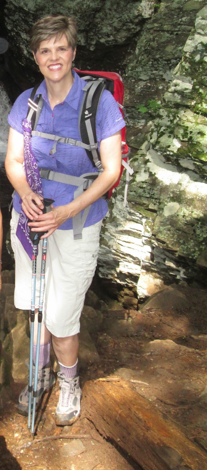
Dressing appropriate for the heat is also important.  I like to keep the sun off my face and neck by wearing a hat.  

On a long, hot-weather hike, sweat clears away more of the electrolytes than you may realize (especially sodium and potassium). These four electrolytes--sodium, chloride, potassium, and magnesium--are important to keep fluids balanced, muscle contractions smooth, nerve impulses firing properly, and energy levels high.  


Below are some great food choices to help you stay refueled.  They are readily found in your local super market as well as easily stowed in your day pack:


SODIUM maintains water balance in the cells and regulates nerve and muscle function: salami, beef jerky, sun-dried tomatoes, and pretzels. 

If you didn't include on your grocery list, most convenience stores sell beef jerky. 


CHLORIDE aids in metabolism: salt, spam, summer sausage, peanut butter (salted), and sun-dried tomatoes. Many of your favorite salty trail snacks contain sodium chloride (salt).   

My personal favorite is a peanut butter sandwich made with crunchy peanut butter and topped  with raspberry or strawberry preserves.  Believe it or not, an "Elvis sandwich" made from peanut butter and banana (minus the butter)  is healthy too.

POTASSIUM helps regulate heart function: white beans, dried apricots, packaged salmon, bananas, dark chocolate, and nuts. My personal favorites are bananas and dark chocolate almonds. 

My favorite supermarket, Publix, sells dark chocolate almonds in their produce section. 

MAGNESIUM aids in heart and immune functions and keeps bones strong: brown rice, black beans, pumpkin, sesame seeds, Brazil nuts, almonds and cashews. 


Who doesn't love Brazil nuts, cashews, or almonds? 


Be sure to drink plenty of water on a long, hot-weather hike, but don't forget to refuel. Hikers who drink a lot of water but neglect to replace electrolytes can suffer from low blood sodium concentration (hyponatremia) which can cause cells to swell (including the brain). If you suspect hyponatremia, move to the shade and eat salty snacks. 

A bladder helps you stay hydrated. 
Most of the resources for this post were obtained through the internet or in Backpacker Magazine. Here is the June 2013 article if you would like to read. 

While I am not a nutritionist or health expert, I do like to be informed before I venture out on those long, hot summer days so I can Keep On Hiking. 


A good choice for dried apricots. 


April 12, 2014

Take the Muir Cure in East Tennessee

Recently I had the pleasure of returning to one of my top five favorite hiking trails: the John Muir Trail No. 152 along the Hiwassee River near Reliance Tennessee. This trail is beautiful any time of the year, but on this particular day, the wildflowers were abundant, the sun was shining, and the dogwoods were blooming. No matter the season, there is no bad time to walk the John Muir Recreation Trail in the Cherokee National Forest. That's why I call it the "Muir Cure." 

John Muir, 1838 - 1914.  (Photograph from http://www.pbs.org/nationalparks/people/historical/muir/.)

A brief history about John Muir and how this trail received its name: John Muir was the founder of the modern environmental movement. He wrote over 10 books on the environment and environmental preservation and was the founder of the first group organized to defend the environment, the Sierra Club. In 1867, while living in Indianapolis, Muir was working as a mechanic in a carriage shop and was temporarily blinded by an accident. He fully recovered his sight after one month which no doubt spurred his commitment to his already developing kinship with nature and his desire to see, experience, and understand all of nature he could possibly find.   

Shortly after recovering his sight, Muir rode the train from Indianapolis, to Louisville, Kentucky to begin a A Thousand Mile Walk to the Sea  which was his first formal written work. Muir walked across Kentucky, passed through the Cumberland Mountains of eastern Kentucky and Tennessee, and then across the Ridge-and-Valley of East Tennessee where he passed through the small towns of Kingston, Philadelphia, and Madisonville. Muir continued through Unicoi Gap into North Carolina through Georgia to Savannah and from there to Florida. He then went on to Cuba. The next year Muir went to California, the Sierra Nevadas, and the love of his life, Yosemite. Here is more information on John Muir in East Tennessee.  


Childers Creek trailhead.    

Muir and his work have been honored in many ways. Tennessee chose to honor the man and the place he trod with the John Muir National Recreation Trail located in the Cherokee National Forest. The trail was constructed in 1972 and is 21 miles along the north side of the beautiful Hiwassee River.  


This trail is also part of the Benton MacKaye Trail. 

The western end of the trail starts near Reliance, Tennessee at the confluence of Childers Creek with the Hiwassee River. From here it extends upriver, reaching the suspension foot bridge of Appalachia Power Plant at six miles. It continues to its intersection with the Coker Creek trail where the trail leads north to the 40 foot high Coker Creek Falls. The Muir trail moves from this trail intersection east where it passes Tennessee State Route 68 and continues on for another three miles ending near to the North Carolina/Tennessee state line. 


 Hiwassee River 

On this particular Spring day, I hiked with the Chattanooga Hiking Club from the Childers Creek trailhead to Towee Creek, a one way 4.2-mile hike, or a 8.4-mile "in and out" hike.


Here are some of the wildflowers you'll see if you take the "Muir Cure" along the John Muir Recreation Trail in the Spring:

Blood Root 

Bluets

Columbine


Dwarf Crested Iris 

Fire Pink


"My path all to-day lead me along the leafy banks of the Hiwassee, a most impressive mountain river.  Its channel is very rough, as it crosses the edges of upturned rock strata, some of them standing at right angles, or glancing off obliquely to right and left."  - from John Muir's A Thousand Mile Walk to the Sea

Jack in the Pulpit 

Longspur Violet

Nodding Trillium 

Lousewort (Photograph courtesy of Wayne Chambers.) 

Phlox


Pussy Toes

The section of the trail from Childers Creek to Towee Creek is moderate and easy terrain.  (Photograph courtesy of Patricia McAlpin.) 

Robin's Plantain (Photograph courtesy of Patricia McAlpin.) 


Rue Anemone (Photograph courtesy of Patricia McAlpin.) 


Spring Beauty (Photograph courtesy of Patricia McAlpin.) 


Yellow Trillium (Photograph courtesy of Patricia McAlpin.) 


Violets (Photograph courtesy of Patricia McAlpin.) 

Even the snakes were enjoying the sunny day.  (Photograph courtesy of Wayne Chambers.) 


Whether hiking on the John Muir Trail or a trail near your home, it's a good way to enjoy the company of others. (Photograph courtesy of Reggie Jay.)

I'll leave you with the river and a splendid quote from John Muir:


 "All the larger streams of uncultivated countries are mysteriously charming and beautiful, whether flowing in mountains or through swamps and plains. Their channels are interestingly sculptured, far more so than the grandest architectural works of man.  The finest of the forests are usually found along their banks, and in the multitude of falls and rapids the wilderness finds a voice.  Such a river is the Hiwassee, with its surface broken to a thousand sparkling gems, and its forest walls vine-draped and flowery as Eden.  And how fine the songs it sings!"  - from John Muir's A Thousand Mile Walk to the Sea


KEEP ON HIKING


Special thanks to Boe Rudder for leading the hike, to Wayne Chambers for help in identifying wildflowers, to Patricia McAlpin for photographs and camaraderie, Quentin R. Bass II for the great online article, and to Reggie Jay for being there.

In case you missed my first blog post ever of my "Top Five Favorite Hiking Trails"  here it is. 

March 30, 2014

The Perfect Urban Hike: Rome, Georgia


Official symbol

For a change of pace, I like urban hiking and want to share my town, Rome, Georgia, with you. A keen interest in history and architecture helped me develop a renewed appreciation for my town along with the discovery of the book, Georgia Walks by Ren and Helen Davis, which includes a walking tour of Rome, as well as tours of many other historical towns in Georgia.  Much of the historical information provided in this post was taken from Georgia Walks


Rome, Georgia is midway between Chattanooga and Atlanta in the Appalachian foothills. It was home to generations of native cultures (Creek and Cherokee) for centuries. In 1832 Floyd County was created by the Georgia Legislature after asserting its claims to the land when the Cherokee were forced west. Rome was selected as the county seat, and the name came from a list of choices drawn from a hat even though some think it came from Rome, Italy as both cities have seven hills.

Due largely to the confluence of three rivers—the Etowah, Oostanaula, and Coosa, Rome became the economic center of northwest Georgia. Boats and barges navigated the three rivers, and a railway spur connected Rome with the main line running from Atlanta to Chattanooga, Tennessee. Factories were built along the waterways, and merchants set up shop.


Confluence of the Etowah, Oostanaula, and Coosa Rivers.  (Photograph courtesy of Beth Hemann.) 

Fortunately, the city escaped total destruction during the Civil War even though much of its industry was wrecked and burned when Union troops captured the city to eliminate Confederate supply sources. After the Civil War, Rome’s importance as a regional transportation and manufacturing center returned it to prosperity. During this time, there were two men who would later gain national prominence working in Rome: Henry W. Grady who would later become editor of the Atlanta Constitution and Woodrow Wilson who would later become President of the United States

Today fine examples of Victorian commercial structures and elegant homes remain as links to this era of rebirth which makes my town of Rome the perfect urban hike. 


Downtown:

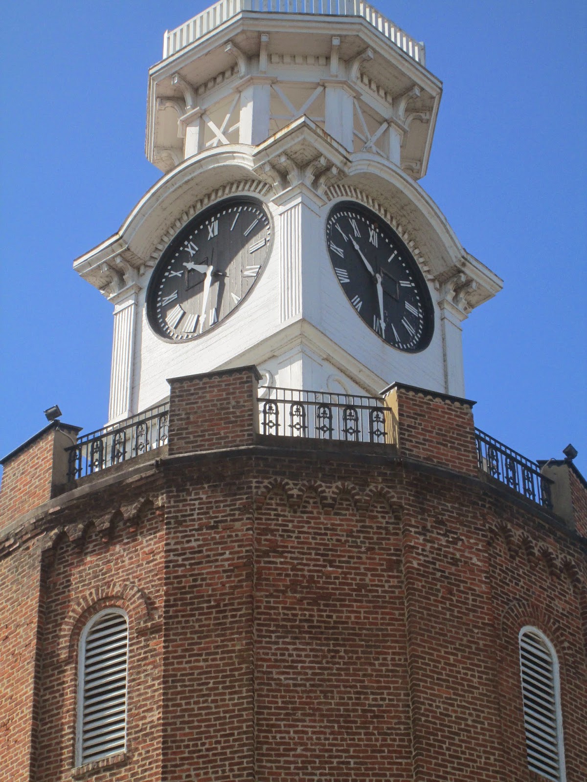
Floyd County Courthouse (1892) noted for its distinctive clock and bell tower. 


The Forrest Hotel, named for Confederate Brigadier General Nathan Bedford Forrest, who helped save the town of Rome in 1863 from Yankee Colonel Abel Streight's Raid.   Here is more about Rome Civil War history.   Sherman arrived in Rome in 1864. 


The Masonic Temple (1877) replaced the original temple burned by Union troops in 1864.   After the war, many Union veterans, who were also Masons, sent contributions to rebuild the temple.   


DeSoto Theatre (1929) was the first in the South designed for "talkies." 

This statue depicting the Capitoline Wolf with Romulus and Remus is at the front entrance of City Hall.  It was a gift to the city from Italian dictator Benito Mussolini in 1929 and was removed during World War II to prevent its being vandalized. 

City Hall (1916) also houses the Rome City Auditorium.

Carnegie Library (1911) was one of the many libraries established by philanthropist Andrew Carnegie.  It now houses city offices as well as offices of local professionals. 


The Robert Redden Memorial Bridge (circa 1900's) is situated over the confluence of the Coosa, Etowah, and Oostanaula Rivers. This old railroad bridge is now a pedestrian walkway to an extensive system of levee trails known as the Heritage Trails.  Here is more information on the Heritage Trails.  


Between the Rivers Historic District:

This historic district is a downtown residential area which includes many lovely homes and churches.  
First Presbyterian Church (1854). 

In this beautiful brick Gothic Revival-style church, Woodrow Wilson met Ellen Axson, daughter of the pastor, the Reverend Samuel Axson, in the summer of 1883. Here is more information on the courtship, marriage, and life of Ellen Axson Wilson. Mrs. Wilson is buried at Rome's Myrtle Hill Cemetery featured later in the post.


First Methodist Church (1884) which is Victorian Greek Renaissance with beautiful mahogany interior woodwork. 


First Baptist Church (1958).  The original church on this site was completed in 1855 and served as a hospital during the Civil War.  Union troops stabled their horses in the basement. 

St. Peter's Episcopal Church (1898).  Known for its beautiful stained-glass windows, the first services were held in the present church on Christmas Day 1898. 

Former manse of St. Peter's Episcopal Church is now used for church offices.


Methodist Parsonage (1856).  This frame, two-story house served as residence of the Methodist minister from 1856 to 1888 and is now an office for a local business. 

The Reverend Samuel Axson House (1867) once owned by Reverend Axson, pastor of the First Presbyterian Church and father-in-law of President Woodrow Wilson. 

The Hillyer House (1885) is a well-proportioned Queen Anne-style house. 


The Fahy House (1893) built by Thomas Fahy for his wife and 11 children.  Daughter Agnes was close friends with Gone With the Wind author Margaret Mitchell, who was a frequent visitor. 

For those of you who remember Wyatt's in downtown Rome, this was the former home of Bobby Wyatt. 

The Columns (1910) Neo Classical Style is currently being renovated.  To follow its progress, be sure to visit its Facebook page, The Columns of Rome.  

Site of Sherman's Headquarters in 1864 during his brief stay in Rome.  The present Greek Revival structure, completed in 1911, is modeled after the Gordon-Lee House in Chickamauga, Georgia. 


A personal favorite of mine.  (Photograph courtesy of Beth Hemann.) 


Perched atop Neely Hill, the Clocktower is one of Rome's most beloved landmarks and is now the official symbol of Rome.  (Photograph courtesy of Jimmye Grimes.) 


The clocktower is actually an old water tower built in the 1870's.  It held 250,000 gallons of water.  No longer a water tower, it is now a museum featuring murals depicting the history of Rome.   Here is more information on the Clocktower and Museum 


If you don't want to climb the 107 steps to the top of the Clocktower, you can enjoy this view of Rome from the top of Neely Hill.  (Photograph courtesy of Beth Hemann.) 


Myrtle Hill Cemetery: 

Situated above the Etowah River, the cemetery is Rome's oldest burial ground and is the final resting place for early pioneers, Civil War soldiers, and prominent citizens including First Lady Ellen Axson Wilson. 


A free mobile app tour can be downloaded here providing a detailed tour of the cemetery. (Photograph courtesy of Beth Hemann.) 


A beautiful panoramic view of the city awaits at the top of Myrtle Hill.  (Photograph courtesy of Beth Hemann.) 


Spring is a beautiful time of year to enjoy an urban hike of Georgia's Rome. Most of the photographs featured in this post were taken in April 2013.  If you are interested in a walking tour of Rome, be sure to visit the Rome-Floyd Visitor's Center for a map. 

I hope you have enjoyed this tour of my town, and challenge you to enjoy an urban hike soon, perhaps in your town or in Rome, so you can "Keep On Hiking."